OS Licence

OS Open Data
OS Open Data
Ordnance Survey has recently opened up access to a number of products with the launch of OS OpenData on 1 April 2010, under the ‘Making Public Data Public’ initiative.

Here’s what they say on the website:

OS OpenData will support digital innovation, democratic accountability and social engagement, and will enable business, government, communities and individuals to benefit from easier access to the use of Geographic Information (GI).

There is a specific licence that covers the use of the OS OpenData products.

Changes: (1) there is NO charge for OS OpenData products and (2) we will have much greater re-use rights under the new licence terms than were previously available for 1:50 000 Gazetteer data.

Check this link out to find out about the new licence regimes, including the Public Viewing Service Licence.

http://www.ordnancesurvey.co.uk/oswebsite/opendata/licence/index.html
30 second guide

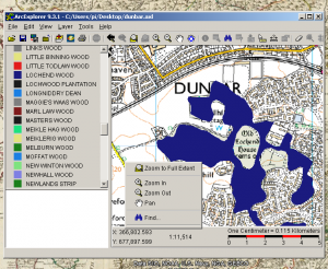
Arc Explorer is Easy to Learn

Each workstation is currently configured independently, but with a similar setup:

  • Map Maker I is the main community facility
  • Map Maker II is being used by Sue, use the Map Maker profile.

Viewing maps or selecting a view to copy into a presentation or publish to a website is quite easy.

Printing good quality basic maps is quite easy.

Creating basic maps with your data is quite easy, but requires considerable discipline.

Using other people’s data, querying and customising views can be difficult.

Making maps of publication quality, with keys can be quite difficult.

Start by reading View Maps with Arc Explorer (Java version)

Creating KML files from Map Maker

We can use OGR2OGR a command line opensource programme, that converts between a wide range of different formats.

Download info is available here.  FWTools is available on Windows, Mac, Linux.

OGR can also reproject the data.

ogr2ogr -f “KML” -s_srs “EPSG:27700” -t_srs EPSG:4326 OutputFile.kml InputFile.shp

will take the UK OS and make it work on Google Maps (e.g. above) or Google Earth.

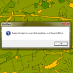
Delete file failed

Delete file failed
Delete file failed
Delete file failed is a common error that appears to follow a range of other errors. Temporary files are created by Map Maker in the background. If an error occurs access to the temporary file is interrupted for some reason and this error is generated and may recur throughout a session.

Solution

Save any work you have done, including Live Layers. If you are working on Styles, make sure you export a set. Restart Map Maker.