All Articles

30 second guide

Arc Explorer is Easy to Learn

Each workstation is currently configured independently, but with a similar setup:

  • Map Maker I is the main community facility
  • Map Maker II is being used by Sue, use the Map Maker profile.

Viewing maps or selecting a view to copy into a presentation or publish to a website is quite easy.

Printing good quality basic maps is quite easy.

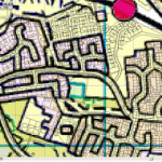
Creating basic maps with your data is quite easy, but requires considerable discipline.

Using other people’s data, querying and customising views can be difficult.

Making maps of publication quality, with keys can be quite difficult.

Start by reading View Maps with Arc Explorer (Java version)

Map Making Guides

Step Guides for Map Maker and Arc Gis Java are designed to help you get up to speed with each application, without burdening you with too much GIS theory in one go.

quicker-by-farWe will publish chapters in groups of 4-6 articles that can be tackled in fairly short sessions and at your own pace, over a period of hours or days to suit your learning pace.

Use the Main Menu to access each chapter and use the Side Menu or Navigation to browse the individual chapters.

When you navigate the chapters, the most recent article should appear first.  If you want to run through each lesson in order navigate using the Sidebar Menu or Navigation buttons.

Dunbar on the map, finally

A little while ago we wrote to Google to ask if they would update their imagery for Dunbar & district. At long last, Google have made the update. I am sure it had little to do with us, but thanks all the same!

Decent resolution images have not been available to Google Maps users, despite their availability elsewhere. In fact, some desert regions had better coverage. I wonder why?

The new images aren’t so up to the minute, but never mind. The earlier ones were so bad that any improvement is welcome. Thanks again Google!

View Larger Map

Why is google maps aerial coverage for East Lothian poor?

Google Maps Poor Dunbar

Poor aerial coverage over parts of East Lothian continues to be a problem with Google Maps.  Some deserts have higher quality imagery available.

It’s almost useless at low resolutions and not available at high in and around Dunbar. Recent good quality imagery exists and is licensed by the folks at Bing, so why hasn’t Google bothered to update?

Continue reading Why is google maps aerial coverage for East Lothian poor?

Map Maker Post Code Tool

To use the utility you must run Map Maker Pro and then open the program MMpostcode.

MMpostcode is located in Map Utilities (alongside the Map Data).

You may need to re-import the postcode data occasionally, but it should be retained from one session to the next.

The data is kept in Map Data > Code-Point Open > data

Choose from the UK data set CSV or EH Post Codes.

Enter the postcode and click Go To.

Post codes are represented as Markers, which can be saved as a .dra file (Menu > Markers > Save markers as … ).

OS Licence

OS Open Data
OS Open Data
Ordnance Survey has recently opened up access to a number of products with the launch of OS OpenData on 1 April 2010, under the ‘Making Public Data Public’ initiative.

Here’s what they say on the website:

OS OpenData will support digital innovation, democratic accountability and social engagement, and will enable business, government, communities and individuals to benefit from easier access to the use of Geographic Information (GI).

There is a specific licence that covers the use of the OS OpenData products.

Changes: (1) there is NO charge for OS OpenData products and (2) we will have much greater re-use rights under the new licence terms than were previously available for 1:50 000 Gazetteer data.

Check this link out to find out about the new licence regimes, including the Public Viewing Service Licence.

http://www.ordnancesurvey.co.uk/oswebsite/opendata/licence/index.html