Dunbar on the map, finally

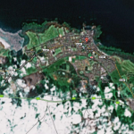
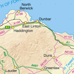
A little while ago we wrote to Google to ask if they would update their imagery for Dunbar & district. At long last, Google have made the update. I am sure it had little to do with us, but thanks all the same!

Decent resolution images have not been available to Google Maps users, despite their availability elsewhere. In fact, some desert regions had better coverage. I wonder why?

The new images aren’t so up to the minute, but never mind. The earlier ones were so bad that any improvement is welcome. Thanks again Google!
View Larger Map

Why is google maps aerial coverage for East Lothian poor?

Google Maps Poor Dunbar

Poor aerial coverage over parts of East Lothian continues to be a problem with Google Maps.  Some deserts have higher quality imagery available.

It’s almost useless at low resolutions and not available at high in and around Dunbar. Recent good quality imagery exists and is licensed by the folks at Bing, so why hasn’t Google bothered to update?

Continue reading Why is google maps aerial coverage for East Lothian poor?

New data sets and updates

Mapping Updates

MapWindow GIS Open Source Software (New!)

Update Tatuk Viewer (much improved!)

Update Mapmaker (Now With Postcode Finder!)

ArcGis Explorer Update (Minor Improvements, incl. Bing Underlay)

OGR2OGR / FWTools (a utility to get shape files into kml and vice versa)

Updated base projects with some of the following new data sets from Ordnance Survey:

1:50 000 Scale Gazetteer – GB | Data type: Point Data | CSV

MiniScale – GB | Data type: Raster | TIFF-LZW (With or without GRid with or without relief)

OS Street View – NT | Data type: Raster | TIFF-LZW

OS VectorMap District – NT | Data type: Raster | TIFF-LZW

OS VectorMap District – NT | Data type: Vector | ESRI Shape

1:250 000 Scale Colour Raster – GB | Data type: Raster | TIFF-LZW

OS Locator – GB | Data type: Point Data | ASCII text, Colon separated

Code-Point Open – GB | Data type: Point Data | CSV (Post Code Data)

Have fun!