The methodology has evolved. Early ambitions included the mapping of old field boundaries, incorporating the 1996 contributions by Sydeserf (some of which are mapped here) and the discussions about which map reference to emply. All this and some good initial datasets (albeit of variable quality) shaped the thinking and the project now has its very own dedicated mapping service, provided by the National Library of Scotland. This is no small achievement. The user front end offers no editing capabilities. Editing is a reserved to trusted individuals, as it requires a fair amount of discipline to digitise well and to enter data in the right format. Re-editing boundaries can only be done in QGIS. However the field data can be re-edited, so as new data comes to light (or errors are spotted), there is no impediment to the trusted individual simply updating the record. That record is immediately live.
Below are the fields that were suggested should be incorporated into the field mapping database …
| Database field name | Length | Guidance | |
| id | System generated | ||
| Farm Name | Text | 50 | Present name |
| Parish | Text | 50 | Present parish |
| Researcher | Text | 100 | |
| Report date | Date | ||
| Introduction | Text | 1500 | General information about the farm and it’s situation. Events affecting farm layout e.g. A1 road building dividing farms & consuming fields. House building. |
| Field Number | Integer | 3 | As recorded on associated farm plan |
| Grid Reference | Text/numbers | 12 | NT format in use |
| Current (field) name | Text | 60 | Name in use today |
| Previous (field) names | Text | 100 | Previous names for a field, from farmer, maps and plans. Names of fields amalgamated to create the present field. |
| Name derivation and analysis | Text | 1500 | Name derivation from function, landscape features, proximity to buildings, roads, etc. Note the use of any earlier terms for land divisions, positions or usage e.g. rigg, acre, dale, shott, buttle. Search for the meaning of any unusual term in the DSL. Reason and date for any name change, field amalgamations & layout changes |
| Other observations | Text | 1500 | Other relevant observations not specific to a field |
| Sources | Text | 1000 | Name of farmer or other informant, map, plan or document references etc. |
| Linguistic analysis | Text | 1500 | (For later use) |
| Analysis date | Date | Date of any later review and analysis e.g. Linguistic analysis | |
| Spare | Text | 1500 | (To give some flexibility should some interesting issue or pattern emerge) |
Following a discussion between DJS & PI 23/8/25
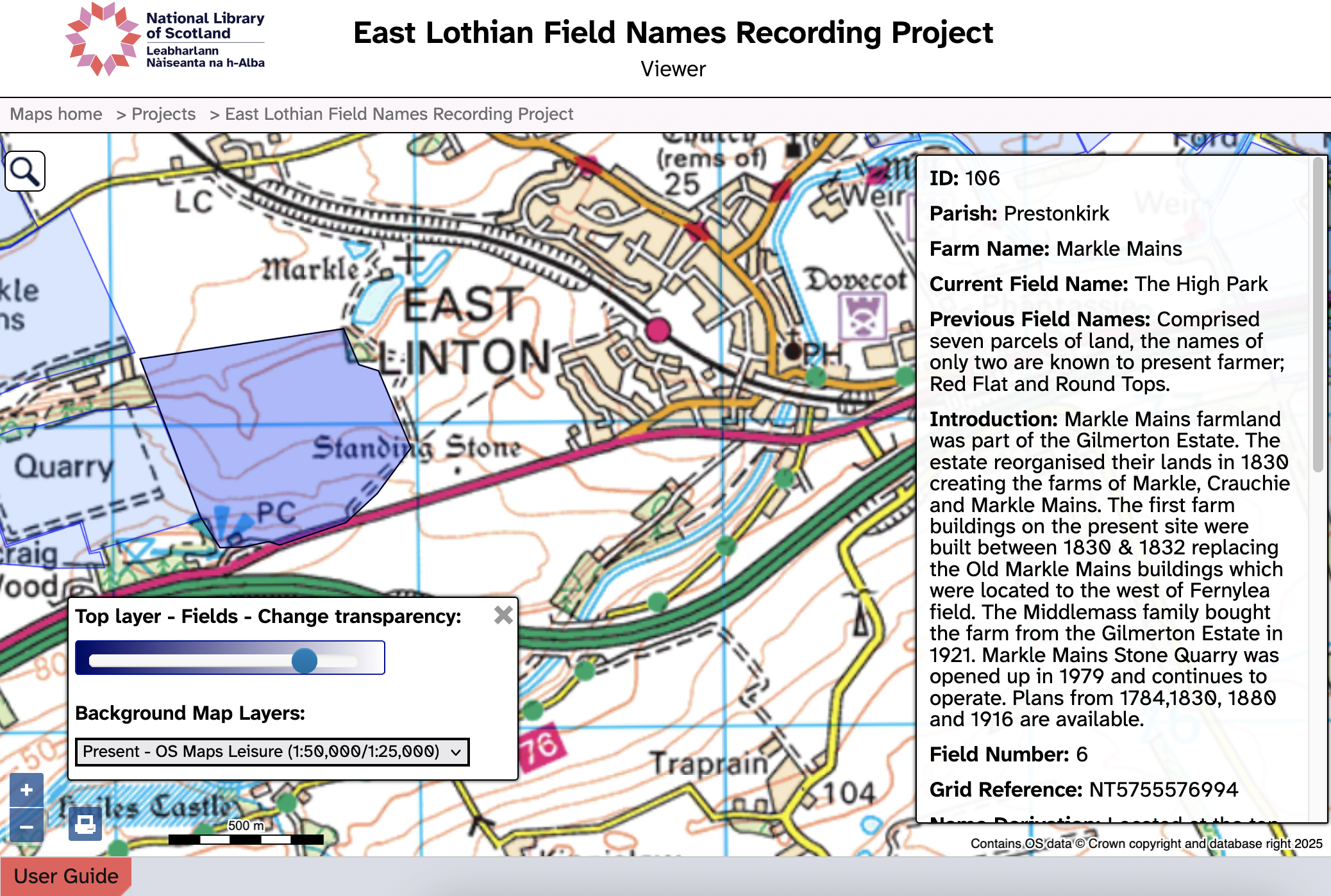
Below is an example of a farm completed, with field boundaries, commentary and initial analysis at Markle Mains (25/10/2025).

The database fields can be queried in QGIS or in a spreadsheet, or extracted into a statistical program where further pattern analysis.