Here is a clear step-by-step methodology summary of the Meath Field Names Project (Phase 1, c.2010–2012), structured like the Borgue project summary and divided into collection, recording, and digital mapping phases:
1. Project Planning & Design
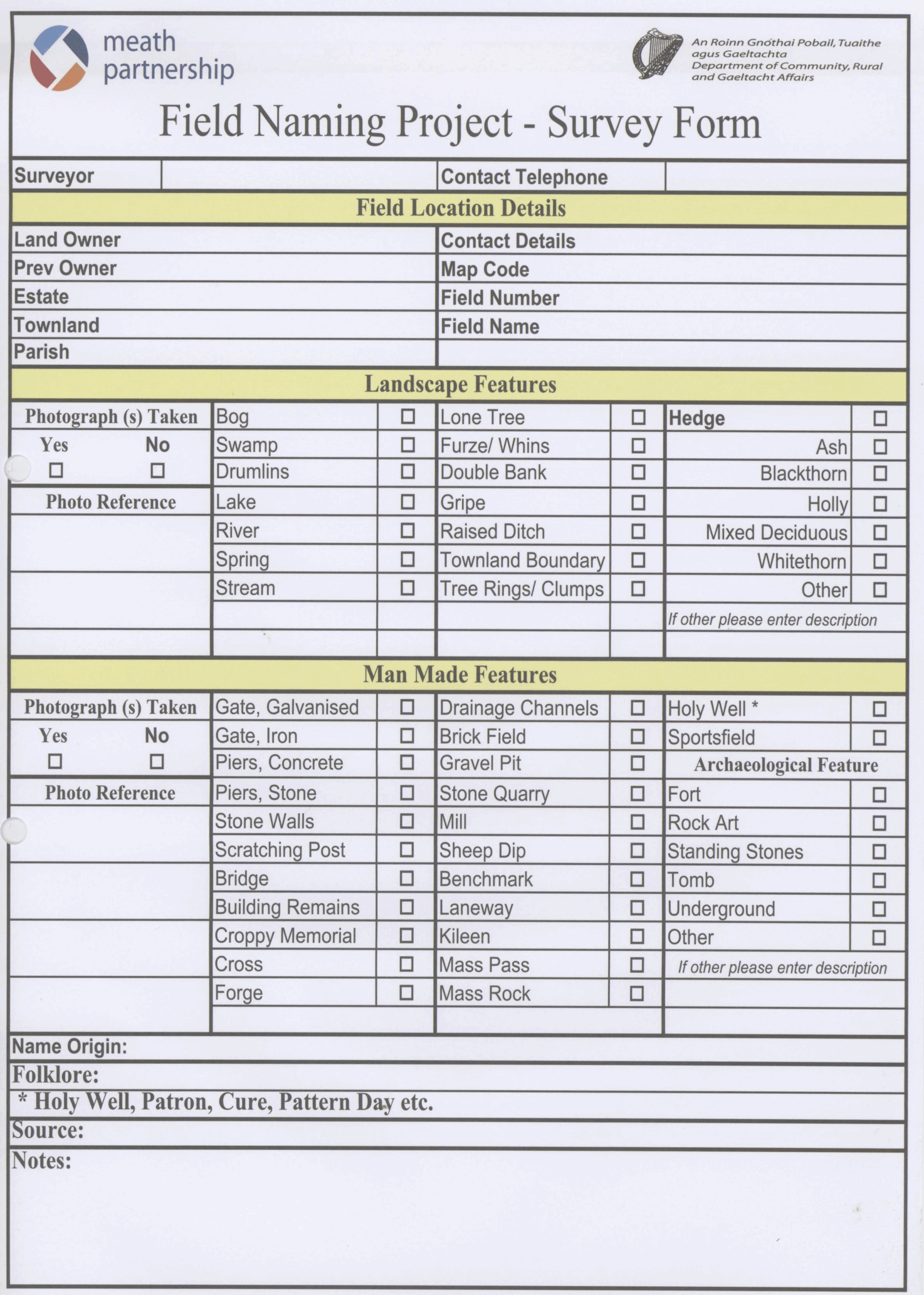
- Mapping & Survey Tools:
- Meath County Council’s spatial services advised on survey sheet and map design.
- Microsoft Access database structure designed early for data capture.
- Field ID System:
- Each field within a townland was manually numbered to assign a unique identifier.
- Volunteers were trained in the numbering system; returning the numbered map was critical.
2. Field Name Collection
- Volunteer-based Survey:
- Volunteers gathered field names and completed both report sheets and manually numbered maps.
- The integrity of the system depended on pairing name data with numbered field maps.
- Data Entry Timeline:
- Data input into the Access database began in September 2010.
- Continued steadily until September 2012, covering all submitted townlands.

3. Database Design & Function
- Database Features:
- Structured for user-friendliness, error minimisation, and query/report generation.
- Each record linked to a specific field within a specific townland using the unique ID.
- Outputs:
- The Access database itself was seen as a core output, enabling future use and analysis.
4. Digital Mapping & Integration
- Software:
- Chose MapInfo for GIS work to ensure compatibility with Meath County Council systems.
- Initial Challenge:
- Explored existing datasets from OSI, Land Registry, and Department of Agriculture—none were usable.
- Digitisation Strategy:
- In Summer 2011, two GIS MSc students from NUI Maynooth began manually digitising fields as polygons.
- ~200 townlands were completed, but scaling the task required professional help.
5. Contracted Digitisation
- Tender Process:
- Public tender issued in May 2012 via eTenders.
- Mallon Technology (Co. Tyrone) awarded contract.
- Completion:
- Full digitisation of all surveyed townlands completed by Autumn 2012.
6. Final Integration & Vision
- Practical Result:
- Each field on the digital map could now be clicked to display all its associated data from the survey.
- Integration with other datasets (e.g. field monuments) planned to enhance research potential.