A weekly snapshot should appear below: first thing on a Sunday morning, and a weekly summary + archive here: Weekly Report
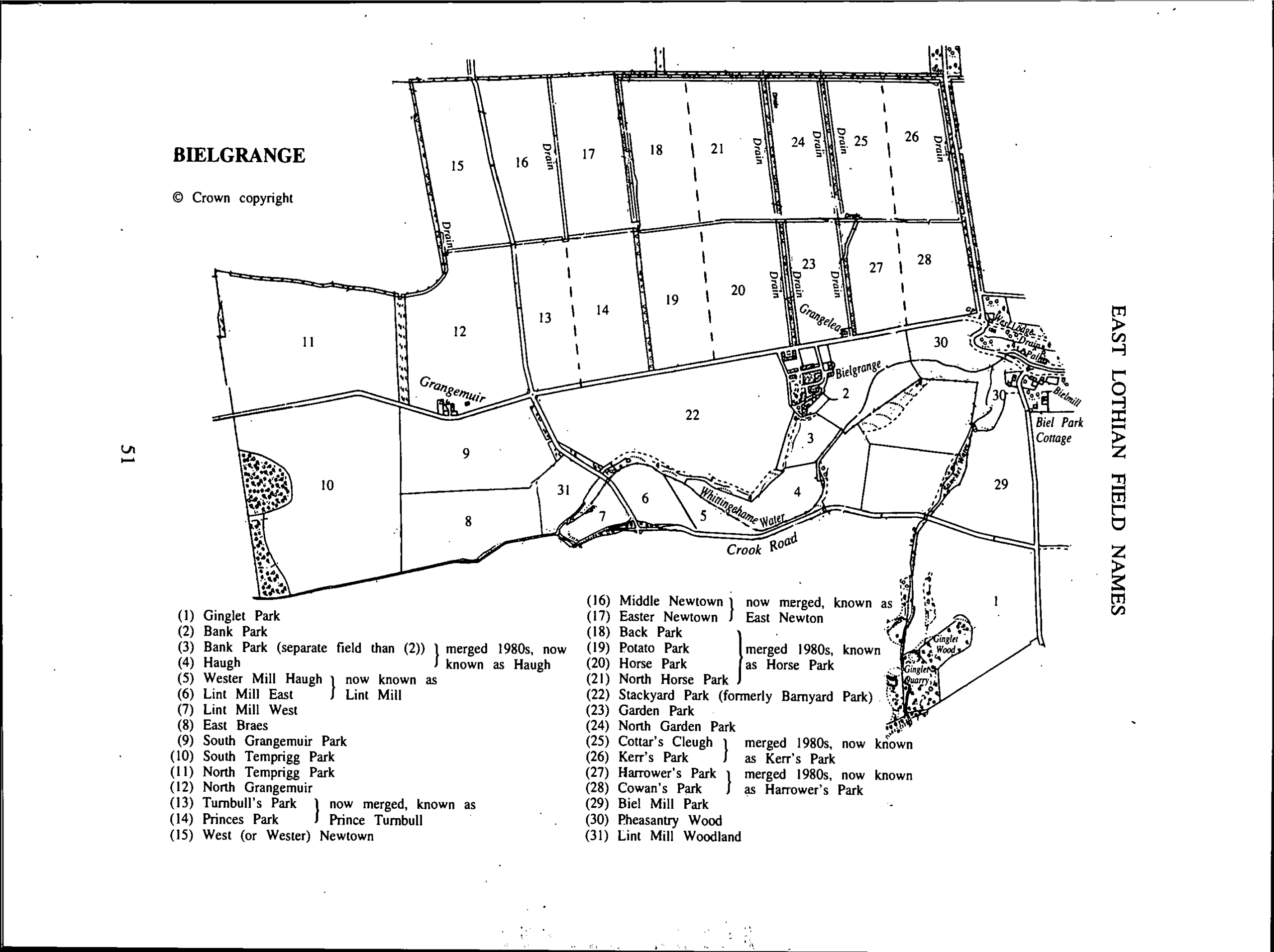
Field Names by Farm
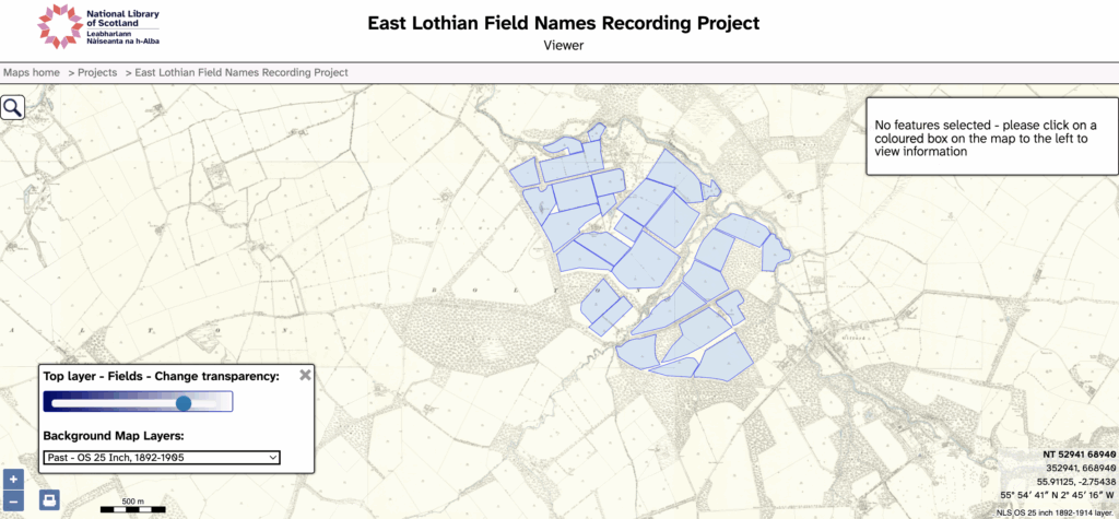
To see the same map with different base layers click here.
Field Names Project Development
Below is Philip’s “unofficial journal”. It covers the early technical progress of the project, with notes on methodology and the approach used by similar projects: Meath and Borgue. The ideas and review of lessons learned allowed the project team to establish a sufficient mapping capability very quickly, moreover without it entailing excessive cost. The interface is almostly entirely self-managed by the research project team, with very limited technical support. The Map team at National Library of Scotland’s crucial initial system support and encouragement is gratefully acknowledged.
Over the past few months I’ve been experimenting with ways to make the East Lothian Field Names project easier to maintain, easier to review and more transparent to contributors. The result is a small but surprisingly useful prototype that now runs automatically each week. In brief Every Sunday morning the system now: The intention is… Continue reading Automating Field Name Progress Tracking
When the field names project was started, you could only search modern place names. Following a discussion with Chris Fleet, we decided to augment the tools. First the ability to search all the database fields was added (and specifically field name, farm name, parish and the long text field). And as of today that place… Continue reading Improved search tool
We have created an experimental GPT to assist with field names research. The GPT assists researchers in investigating the etymology and historical origins of Scottish place names and field names. It approaches each query as a structured linguistic and historical analysis: first confirming geographic location and regional context, then examining potential linguistic roots across Gaelic,… Continue reading Scottish Place Name Helper
As we approach the end of the year, it is useful to chart progress. Just over 150 fields have been recorded across 12 holdings. A downloadable CSV file has been created of the output of the 6 active researchers. Farm Names Count Alderston Mains 19 Broadwoodside 10 Crookston 8 Dolphingstone 21 Duncanlaw 16 Eaglescairnie Mains… Continue reading Field Names Progress
We’ve automated a weekly snapshot of the data, in a format called geojson and rendered on the front page of this site (and also below). Anyone can download a weekly snapshot directly. The format for the url is: https://ourlocality.org/nls-fieldnames/fieldnames_2025-12-07.geojson For convenience, the latest snapshot can downloaded always thus: https://ourlocality.org/nls-fieldnames/latest.geojson If importing into a new project,… Continue reading Field Names Data Snapshots
We have a limited set of alternative basemaps available through the Felt mapping tool and others served by OS (Premium) and a clutch from the National Library of Scotland. Click the map tool to see the drop down options. We can expand this as and when. Please don’t abuse the tool for non “field map”… Continue reading Access Basemaps via Felt
Navigating the NLS map is straightforward and simple, but how do you share the exact view say of a field with a mapping layer? Step 1: navigate to the farm and or field (you can use modern place names to search); Step 2: choose a mapping layer e.g. the 25″ map (bottom left); Step 3:… Continue reading How to share the NLS field names map
The methodology has evolved. Early ambitions included the mapping of old field boundaries, incorporating the 1996 contributions by Sydeserf (some of which are mapped here) and the discussions about which map reference to emply. All this and some good initial datasets (albeit of variable quality) shaped the thinking and the project now has its very… Continue reading The methodology
We have taken the Monkrigg example, collected by David Sowerby as it illustrates what we are trying to do, to shoehorn data from different researchers – who have approached the problem differently – into a single but simple template. David’s example illustrates the difficulties of incorporating diachronic data (from 2 or more different periods), so… Continue reading Method development